🎉 Up to 70% Off Selected ItemsShop Sale
$5.96
Original: $19.85
-70%Children's Illustrated Atlas—
$19.85
$5.96The Story
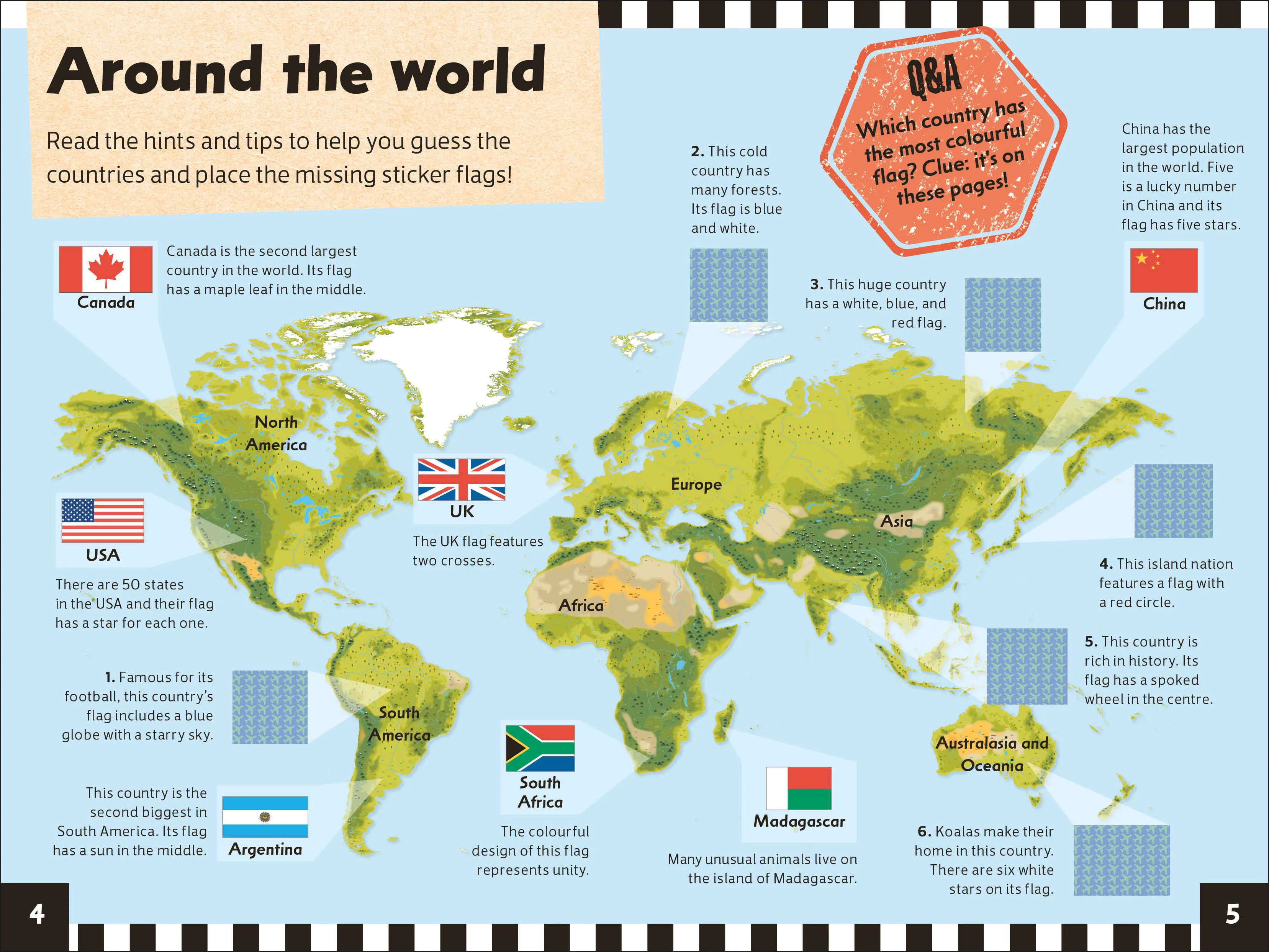
Set off on a thrilling journey around the world.
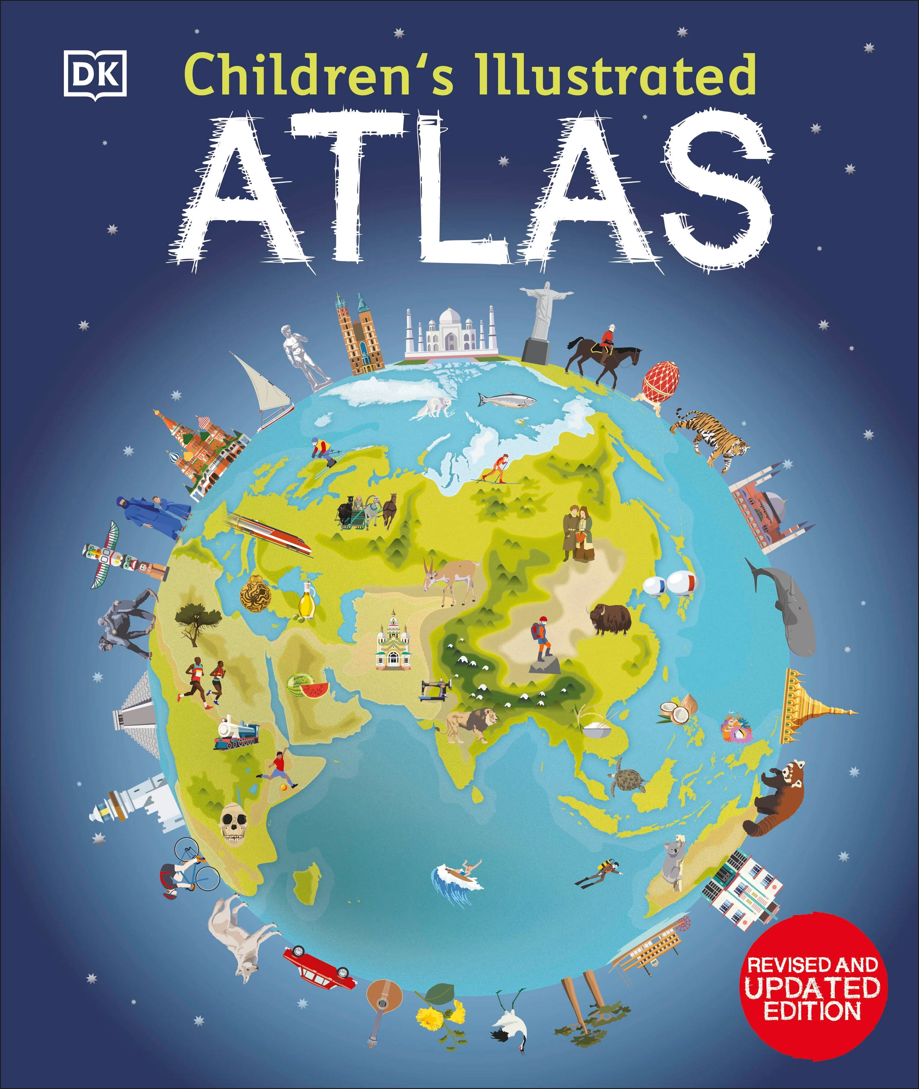
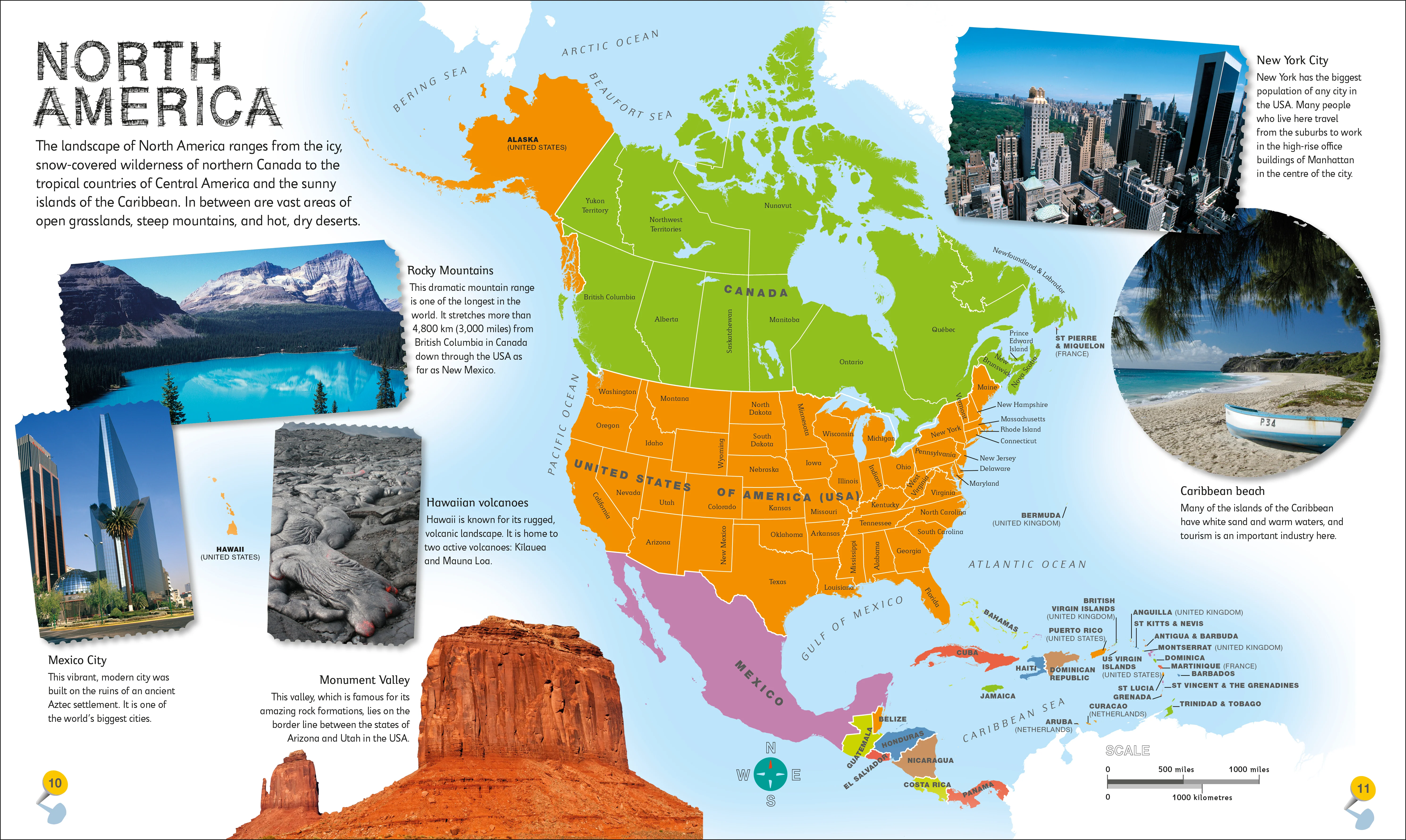
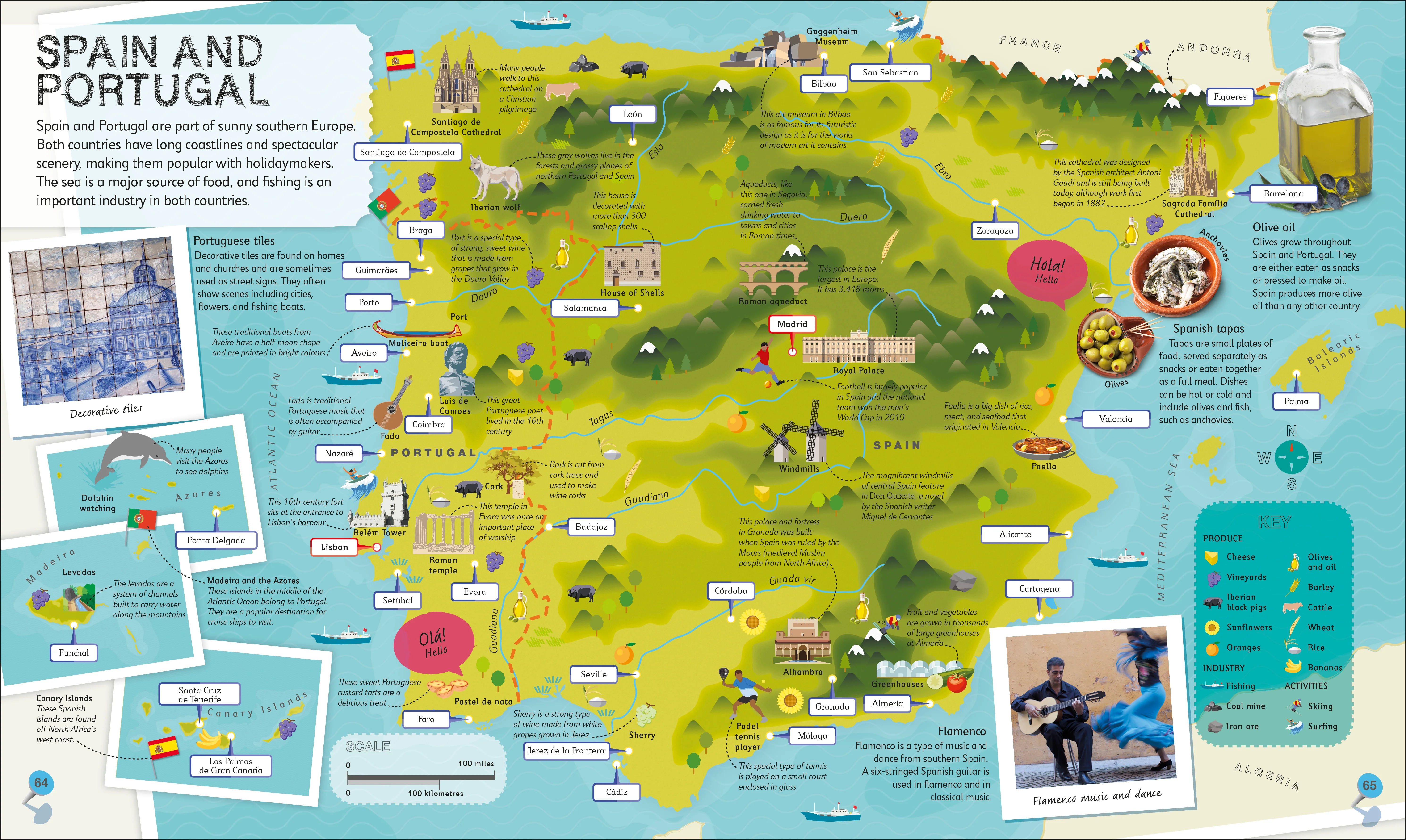
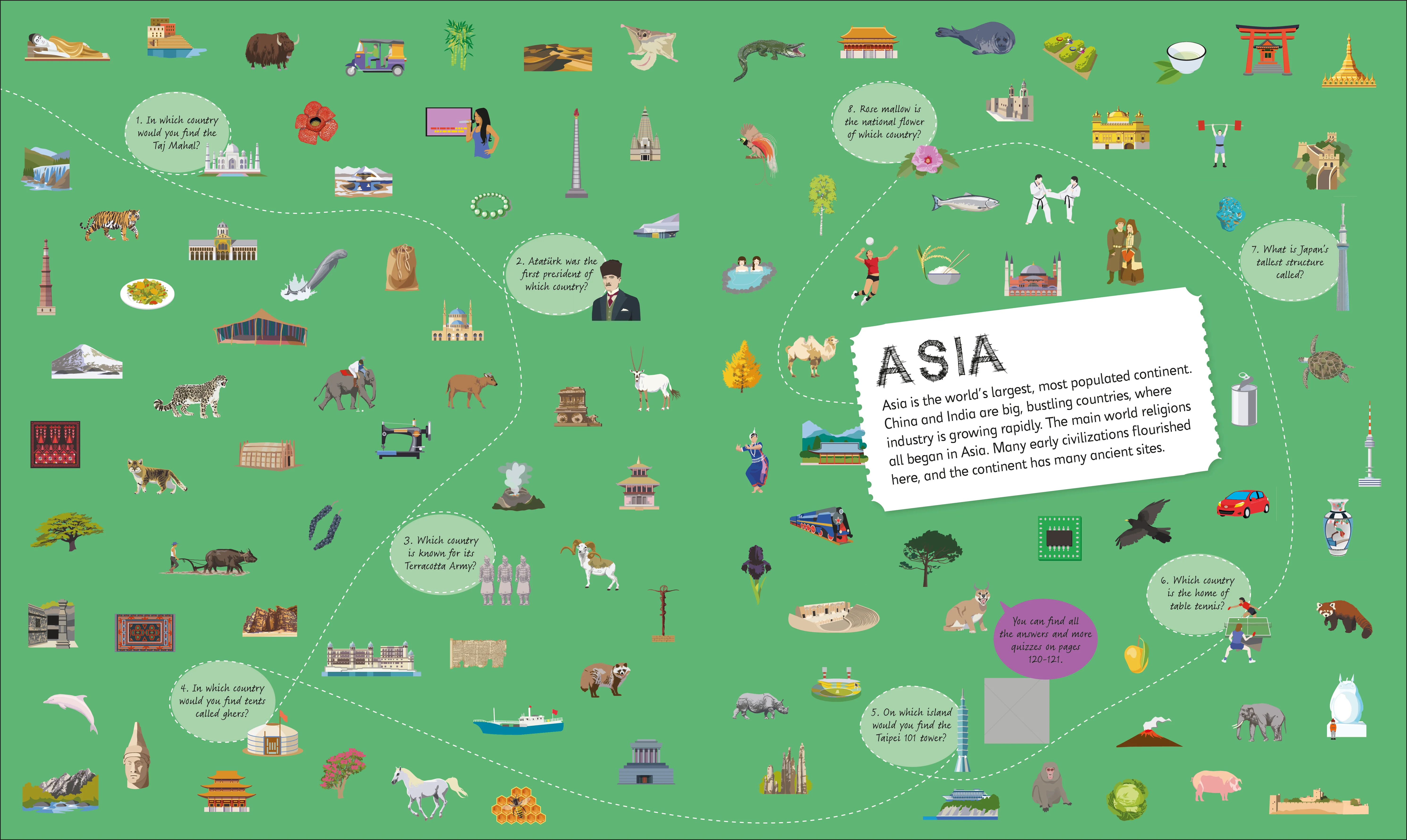
DK's Children's Illustrated Atlas brings the world to life with colourful maps and fascinating facts about the countries of the world.
Each map is bursting with information, combining colourful icons with photographs representing key points about each
country. The atlas includes a world map, with a political map for each continent. Children are shown how to read a map and use a key, compass, and scale. This charming and informative book is a key addition to every child's library.
Details & Craftsmanship
Every detail has been carefully considered to bring you the perfect product.
Details & Craftsmanship
Every detail has been carefully considered to bring you the perfect product.
Details & Craftsmanship
Every detail has been carefully considered to bring you the perfect product.
Description
Set off on a thrilling journey around the world.
DK's Children's Illustrated Atlas brings the world to life with colourful maps and fascinating facts about the countries of the world.
Each map is bursting with information, combining colourful icons with photographs representing key points about each
country. The atlas includes a world map, with a political map for each continent. Children are shown how to read a map and use a key, compass, and scale. This charming and informative book is a key addition to every child's library.