🎉 Up to 70% Off Selected ItemsShop Sale
$23.82
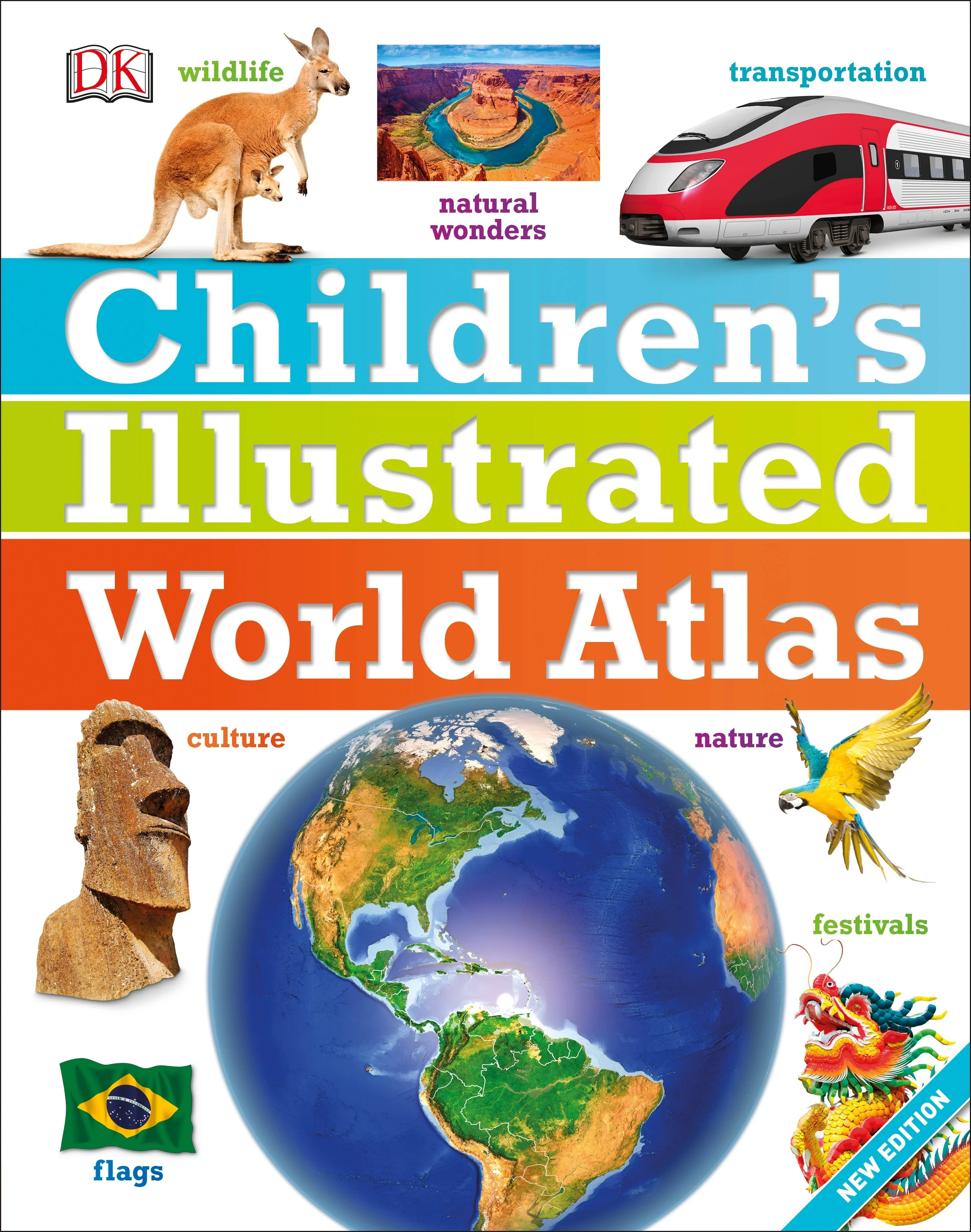
Children's Illustrated World Atlas—
$23.82
The Story
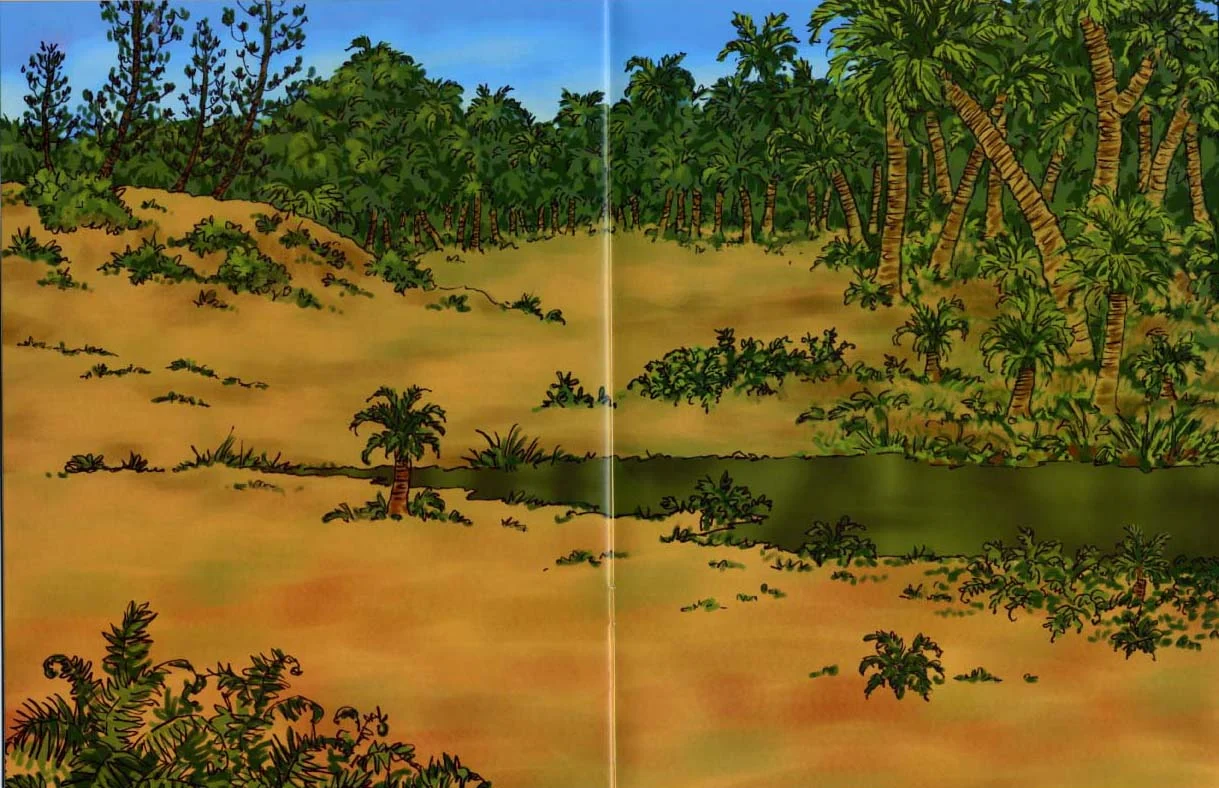
From Bolivia's bustling markets to the massive and scorching Sahara Desert, see the world with this beautifully illustrated atlas.
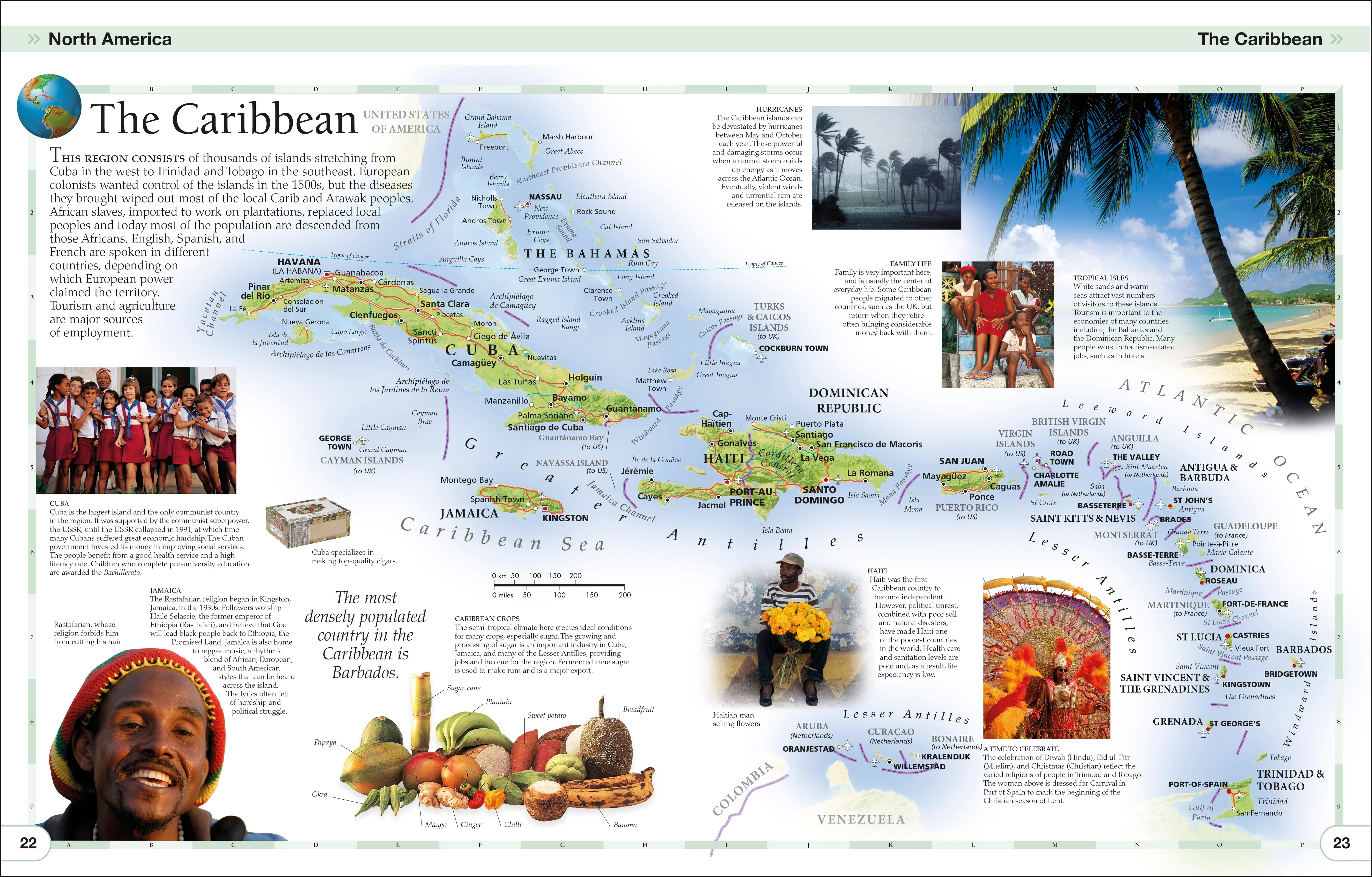
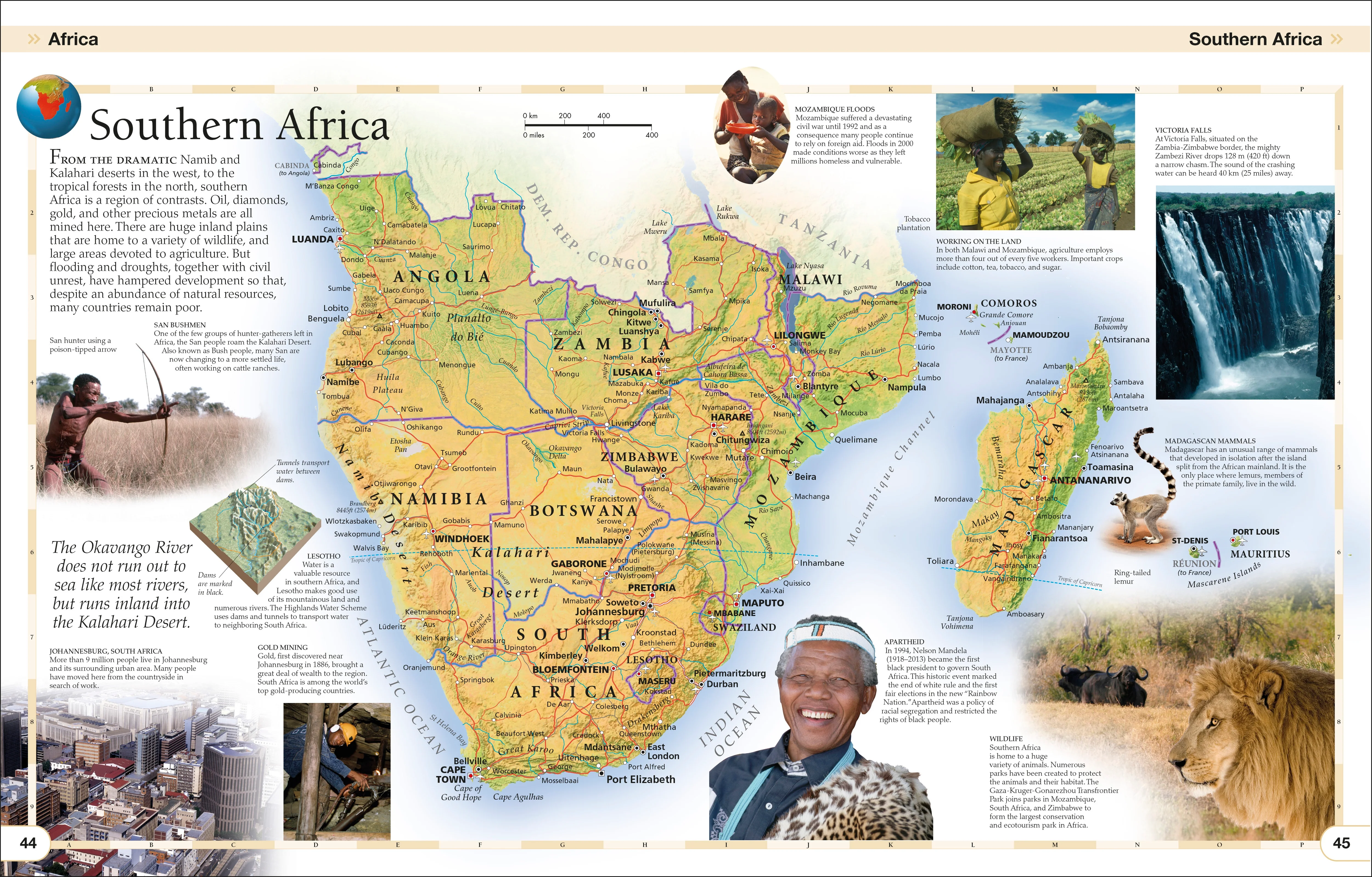
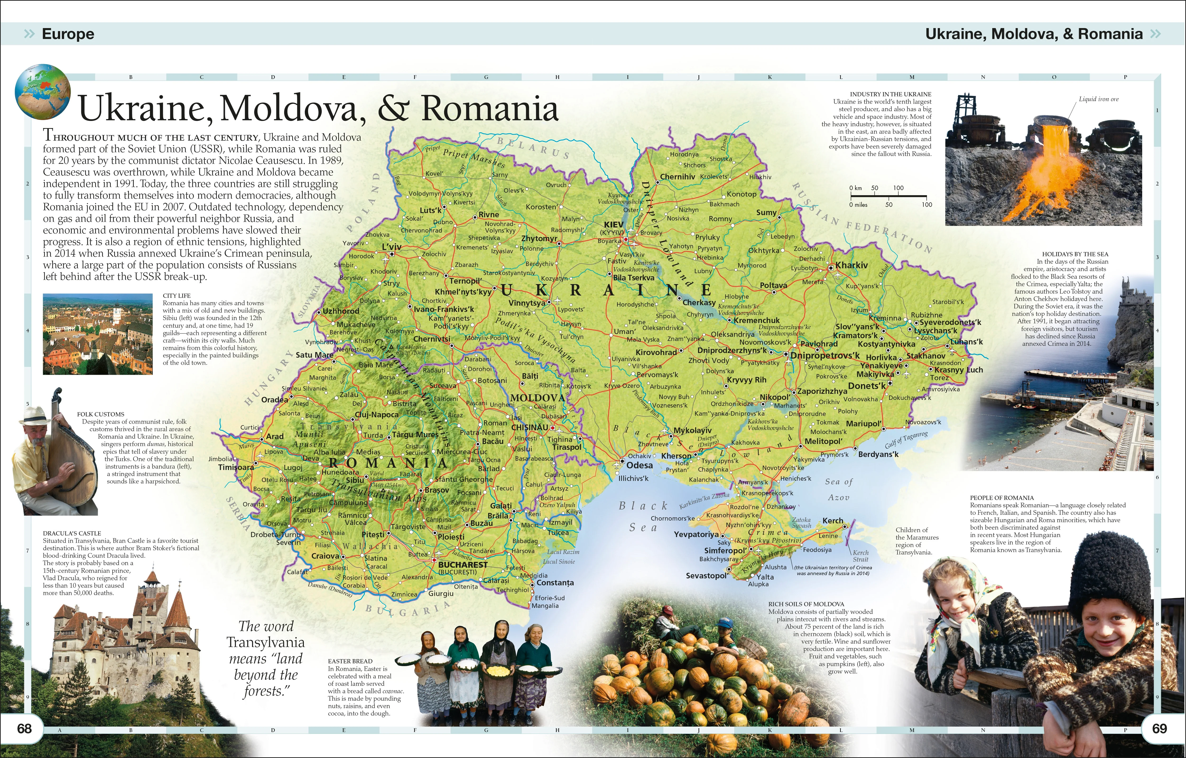
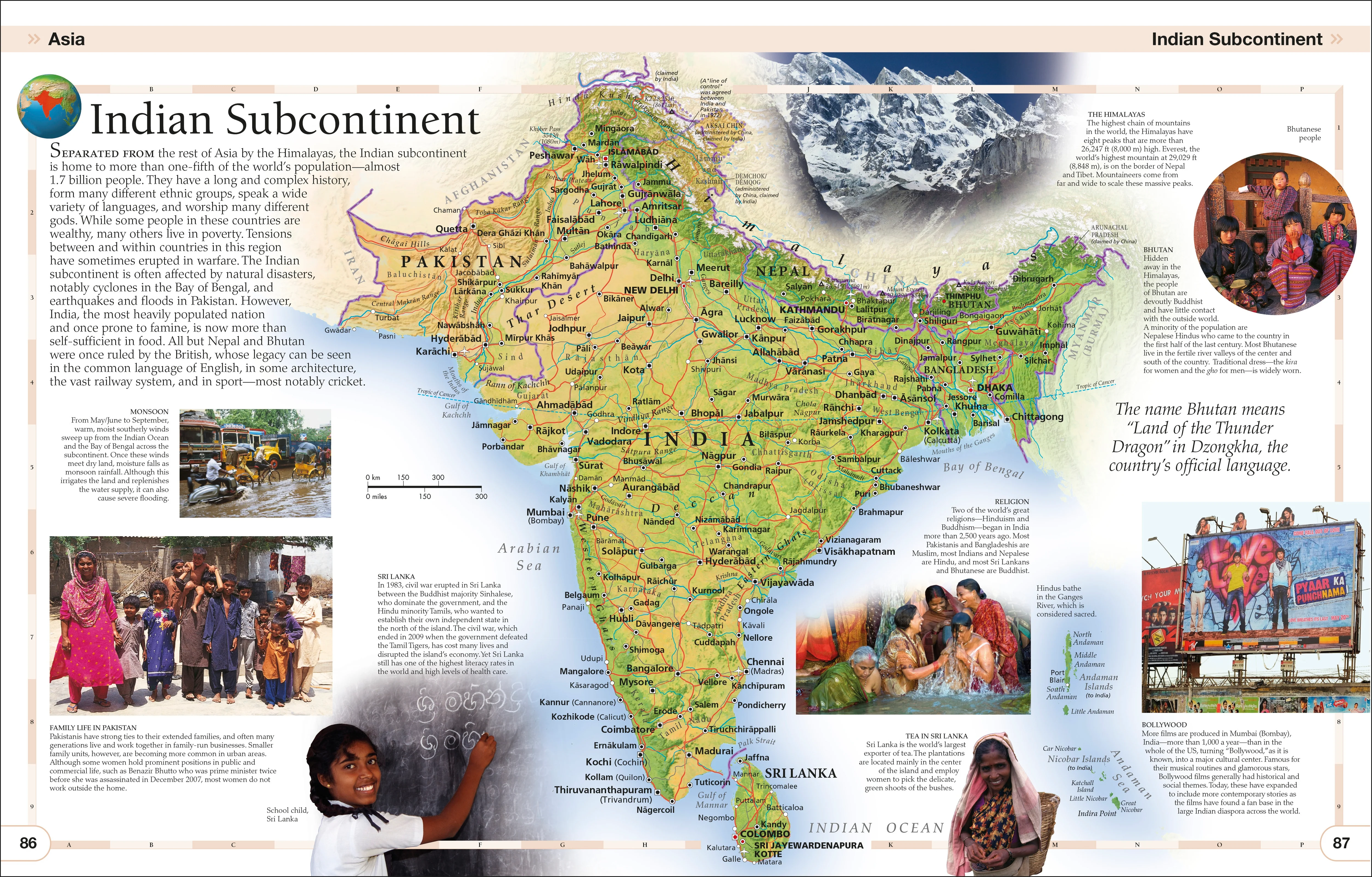
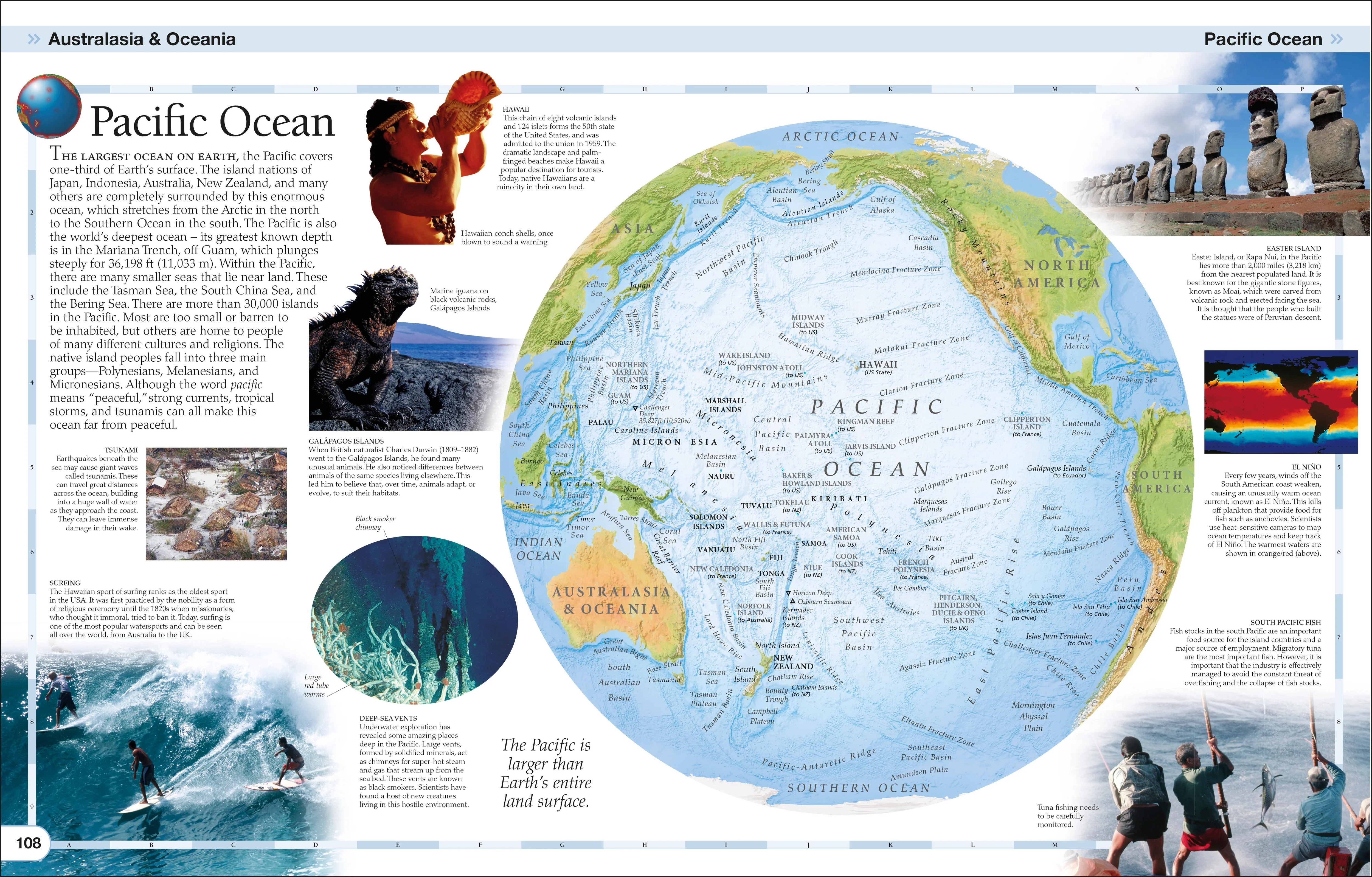
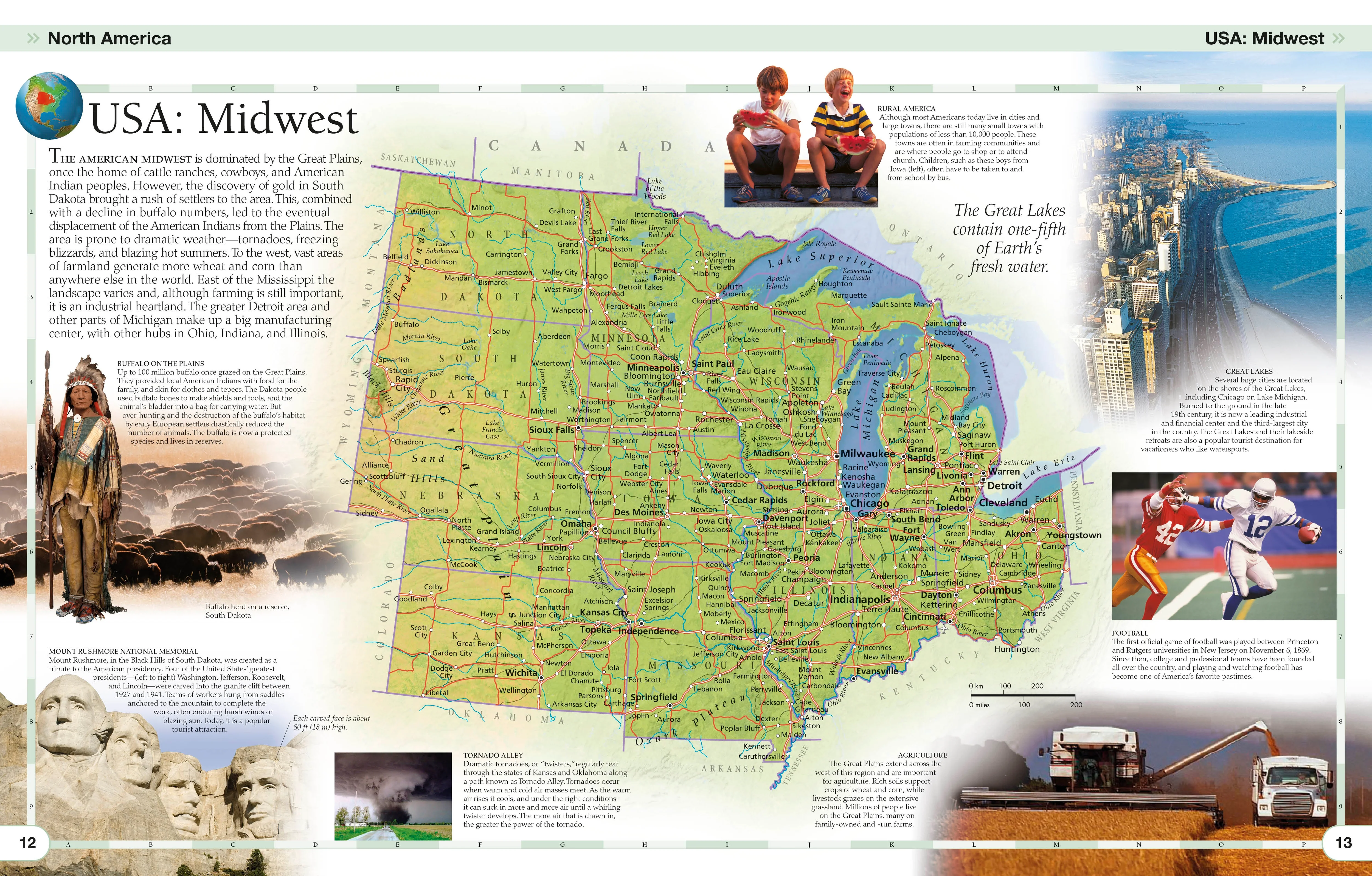
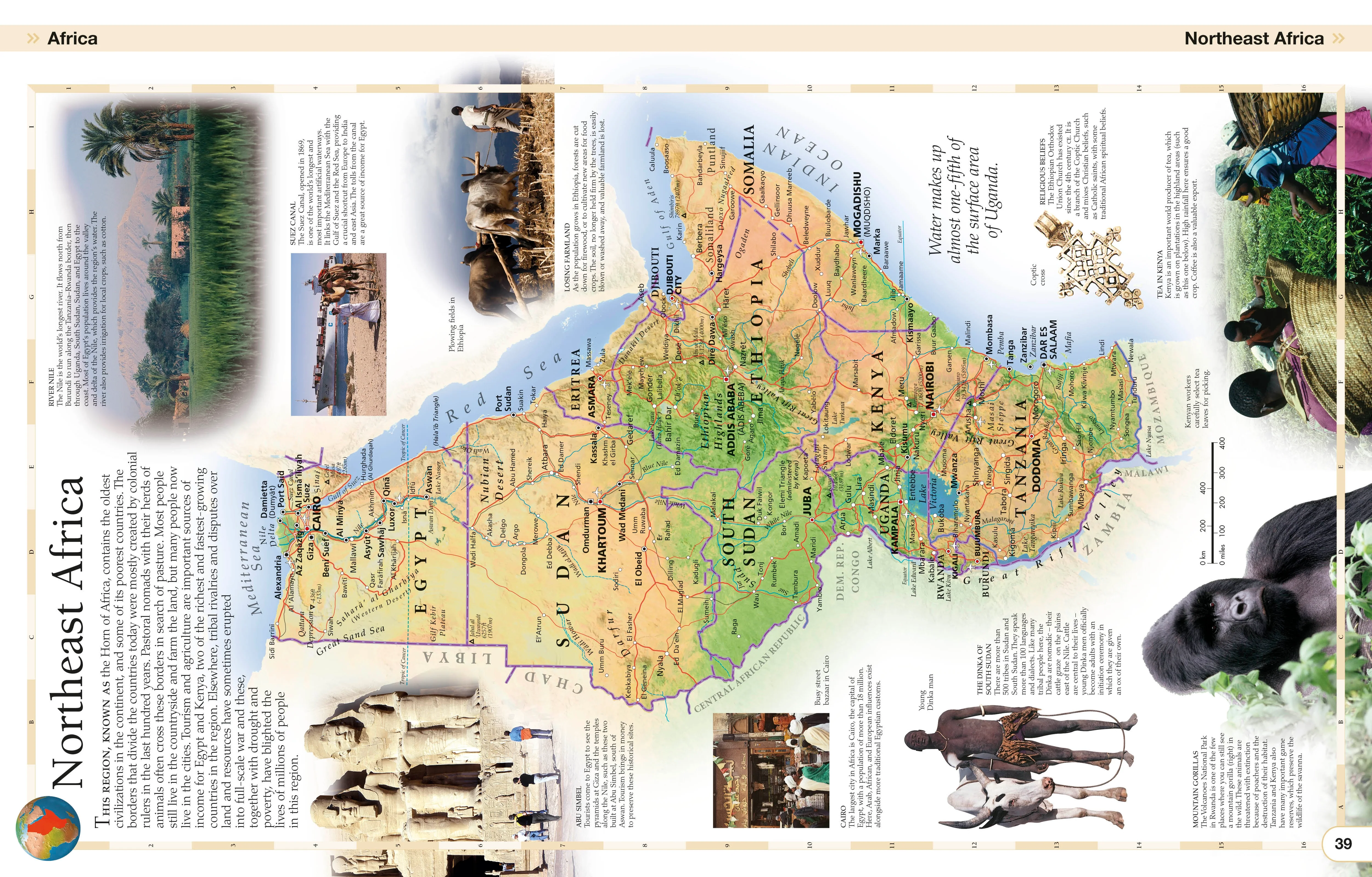
Children’s Illustrated World Atlas is divided into six main sections, each devoted to a continent. Within each continent, a country or a region is explored in detail through stunning maps showcasing cities, towns, rivers, mountain ranges, and other geographical features.
Apart from the geography of a region, Children’s Illustrated World Atlas also provides interesting information about the people, their traditions, politics, and economics through spectacular images and snippets of facts.
Take a trip around the world with Children’s Illustrated World Atlas, from the majestic Himalayas to the Carnival of Venice. This colorful and comprehensive book is the perfect addition to every book shelf at home or school.
Details & Craftsmanship
Every detail has been carefully considered to bring you the perfect product.
Details & Craftsmanship
Every detail has been carefully considered to bring you the perfect product.
Details & Craftsmanship
Every detail has been carefully considered to bring you the perfect product.
Details & Craftsmanship
Every detail has been carefully considered to bring you the perfect product.
Details & Craftsmanship
Every detail has been carefully considered to bring you the perfect product.
Details & Craftsmanship
Every detail has been carefully considered to bring you the perfect product.
Details & Craftsmanship
Every detail has been carefully considered to bring you the perfect product.
Description
From Bolivia's bustling markets to the massive and scorching Sahara Desert, see the world with this beautifully illustrated atlas.
Children’s Illustrated World Atlas is divided into six main sections, each devoted to a continent. Within each continent, a country or a region is explored in detail through stunning maps showcasing cities, towns, rivers, mountain ranges, and other geographical features.
Apart from the geography of a region, Children’s Illustrated World Atlas also provides interesting information about the people, their traditions, politics, and economics through spectacular images and snippets of facts.
Take a trip around the world with Children’s Illustrated World Atlas, from the majestic Himalayas to the Carnival of Venice. This colorful and comprehensive book is the perfect addition to every book shelf at home or school.